Public
- iowisota
- Jan 6, 2025
- 4 min read
Tens of thousands of acres of “public land” lie within 50 miles of Iowisota. This immense network of federal, state, county and municipal public lands is managed under a diverse set of purposes and permissions. If we like to forage, birdwatch, hunt, or just explore, understanding these differences helps us all to enjoy these lands appropriately.

In the Midwest, our main federal lands are managed by the US Forest Service, the National Park Service, the US Fish and Wildlife Service, and the Army Corps of Engineers. The National Forests are managed for “multiple use”, including recreation, timber production, and wildlife habitat. But Iowa doesn’t have any National Forests; I must go to our neighboring States to enjoy the Chequamegon-Nicolet NF in Wisconsin, the Chippewa and Superior NFs in Minnesota, the Mark Twain NF in Missouri, and the Shawnee NF in Illinois. After a 30+ year career of working for the USDA Forest Service to help land managers maintain forest health, I have a bit of a soft spot in my heart for National Forests and their multiple use purpose. I particularly love to paddle into the Boundary Waters Canoe Area Wilderness on the Superior NF, but the 7-hour drive is a bit daunting!
Iowa doesn’t have any National Parks either, but we do have Effigy Mounds National Monument, which is managed by the National Park Service. National Monuments are set aside by presidential proclamation to preserve historical, cultural or scientific resources. The 2500 acres of Effigy Mounds National Monument are managed to preserve and interpret over 200 Native American mounds, as well as a culturally and ecologically significant landscape. As a general rule, visitors to National Park Service sites can enjoy observing nature, but cannot disturb vegetation, wildlife, or other natural features.
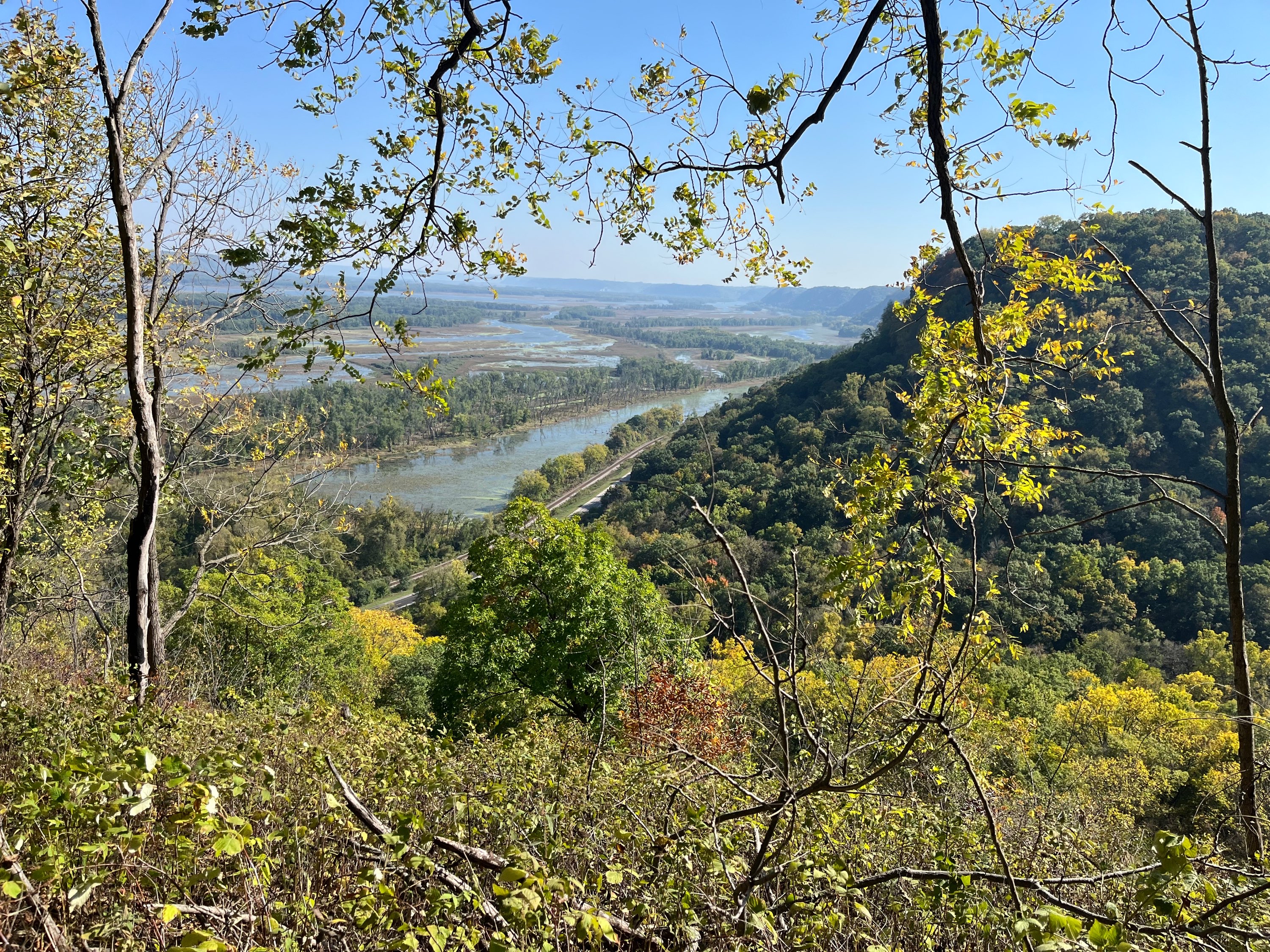
The most amazing piece of federal land close to Iowisota is the Upper Mississippi National Wildlife and Fish Refuge (UMRNWFR). This 240,000-acre marvel is right out our front door. It stretches for 261 river miles along the Mississippi River from Wabasha, Minnesota, to Rock Island, Illinois, and is managed primarily by the Army Corps of Engineers and the US Fish and Wildlife Service. The main purpose for the Army Corps involvement is River navigation, but they also manage boat landings and campgrounds and do a surprising amount of forest management and wildlife habitat restoration. The main purpose of US Fish and Wildlife Service involvement is to protect wildlife and their habitat for the next generations; the UMRNWFR is a Wetland of International Importance and a Globally Important Bird Area. I’d argue that the UMRNWFR is the largest contiguous temperate floodplain forest in the world; that seems pretty special to me! Visitors to the UMRNWFR enjoy hunting, fishing, wildlife observation, boating, and other recreation. It is necessary to obtain a permit for commercial activities within the Refuge, and there are some limitations and guidelines for what plants can be harvested.
But our federal lands are only a small part of the picture. In Allamakee County (Iowa), we have Yellow River State Forest, consisting of 8990 scenic acres set aside for camping, fishing, hiking, and active forest management. YRSF has rippling trout streams and 48 miles of equestrian and hiking trails. Note that this is a State Forest, with active forest management and the designated purpose of “multiple use”, as opposed to a State Park, which has the designated purpose of preservation. Pike’s Peak State Park near McGregor is an example of a popular nearby State Park, with stunning scenic views and 11 miles of hiking trails. The only types of plant material that can be removed and harvested in State Parks are mushrooms, asparagus, nuts, fruits and berries; Hunting and trapping are prohibited. But wait, there’s more… In addition to our State Parks and State Forests, Iowa also has Wildlife Management Areas (WMAs) that are funded entirely by revenues from sale of hunting, fishing, and trapping licenses. Allamakee County alone has over 10,000 acres of this State land available for hiking, foraging, hunting, and other compatible uses. One WMA is within 1000’ feet of Iowisota! Wisconsin and Minnesota have similar abundance of State Parks, Forests, and other State Lands.
I would be remiss to not mention the County and Municipal Parks. The Allamakee County Conservation Board manages the Driftless Area Education and Visitor Center on the south side of Lansing, where you can learn about the geology, ecology, and cultural history of the Driftless Area. And the entrance price to this resource is FREE. The ACCB also manages 28 other parks, boat ramps, and canoe landings on over 158 acres across the County. Lastly, there are also some wonderful municipal parks scattered about. For instance, in Lansing’s Mount Hosmer Veterans Park you can drive to the top of a bluff to take in breathtaking views of the Mississippi Rive or hike for hours on 7 miles of winding trails. In Decorah, you can find a trout stream flowing out of the side of the bluff at Dunning’s Spring Park.
This blog post has been an “infomercial” for public lands. My point is that there is probably more available to you than you realize, and there are many choices of what type of site you will want to visit, depending on what you want to do. I love the piece of private woodlands we steward, but I also consider Iowisota a “jumping off point” to so much more!
Housekeeping paragraph: We do still have some spaces left in our workshop, “After the Hunt: Cooking with Venison | Iowisota”, that will be taught by Chris Gavin on January 11th. I will eventually be adding other fee and free 2025 events and activities; maple syrup making is not that far away! We are also taking reservations for private retreats and overnight stays in the guest rooms and cabin.
Until next time… Happy 2025, get out there and enjoy it!


This blog post is a dream to my adventurous heart. I have been so curious about where to explore near driftless region. Thank you for this informative resource